HIGHLIGHTS
The Palay Production Survey (PPS) is one of the major agricultural surveys conducted by the Philippine Statistics Authority (PSA). This generates estimates on palay production, area, yield, and other production-related data that serve as inputs for policy making and programs on palay/rice.
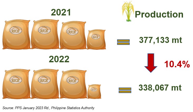
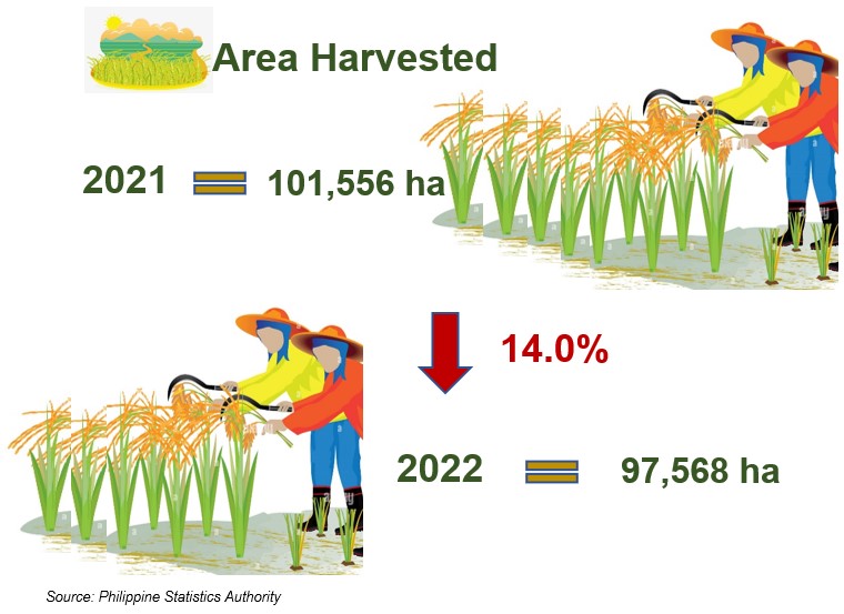
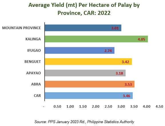
In 2022, total palay production in the Cordillera went down to 338,067 metric tons (mt) from the previous year’s level of 377,133 mt or a decrease of 10.4 percent. This was attributed to the reduction in harvest area from 101,556 hectares (ha) in 2021 to 97,568 ha in 2022 or 14.0 percent decrease. A drop in average yield per hectare was observed from last year’s record of 3.71 mt to 3.46 mt this year.
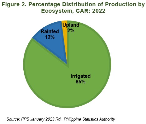
Palay production from irrigated farms during the year 2022 shared about 85 percent (288,562 mt) to the total regional production. Meanwhile, rainfed farms shared 13 percent (42,633 mt) and upland farms shared 2 percent (6,872mt).
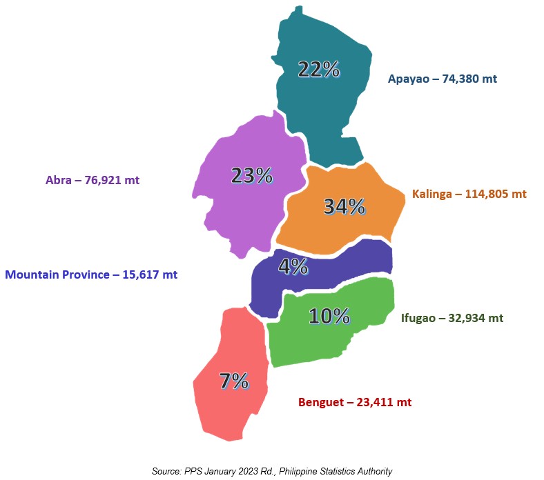
In 2022, the province of Kalinga contributed about 34 percent (114,805 mt) to the total palay production in the region. This was followed by Abra with 23 percent share (76,921mt), Apayao with 22 percent share (74,380 mt), Ifugao with 10 percent share (32,934 mt), and Benguet with 7 percent share (23,411 mt). Meanwhile, Mountain Province contributed the least at 4 percent (15,617 mt).
In terms of average yield per hectare, Kalinga recorded the highest yield in 2022 with 4.05 mt, followed by Abra with 3.53 mt, Benguet with 3.42 mt and Apayao with 3.18 mt Mountain Province and Ifugao recorded the lowest yield with 3.01 and 2.74 mt, respectively.
VILLAFE P. ALIBUYOG
Regional Director
_____________________________________________________________________________________________________________________________________
TECHNICAL NOTES
Production - quantity produced and actually harvested during the reference period. It includes those harvested but damaged, stolen, given away, consumed, given as harvesters’ and threshers’ shares, reserved, etc. Palay production from seed growers which are intended for seed purposes is excluded from the survey.
Area harvested - actual area from which harvests are realized. This excludes crop areas which were totally damaged. It may be smaller than the area planted.
Yield - is an indicator of productivity derived by dividing total production by the area harvested.
Irrigated - area with irrigation facilities supplying water through artificial means like gravity, force/power, pump, etc. Irrigated area become rainfed only, when the irrigation system is no longer operational for the past two (2) years and beyond repair and there is no plan of irrigating the farm.
Rainfed – area which holds standing water but solely dependent on rainfall for its water supply. It may have dikes that retain rainwater.
Upland - farm land which has no amenities to hold for standing water. It is usually located along elevated lands, along rivers, between hills, hillsides, etc. Though crops planted in this type of ecosystem are drought-resistant and do not require standing water for their normal growth, irrigation by flushing is sometimes practiced to improve the crops’ performance especially during the long dry spell.

